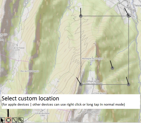
XCwing
Lat: N
Lon: E
Speed:
Height:
Temperature:
Precipitation:
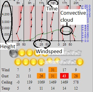
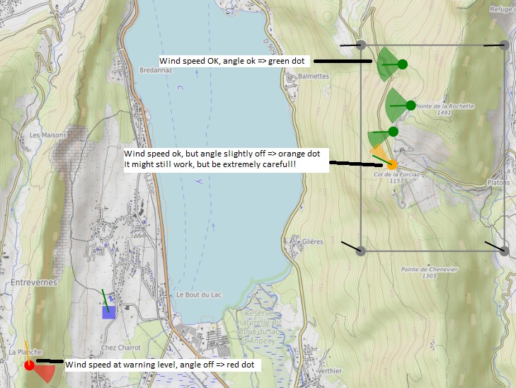
Always safe Windspeed (ignore direction):
Windspeed warning (orange):
Windspeed Alarm (red):
Use icon-D2 model as groundwind.
(Datapoints are closer together, but is only available for parts of Europe.
Usefull in complex valley-systems (ex: The Alps)).
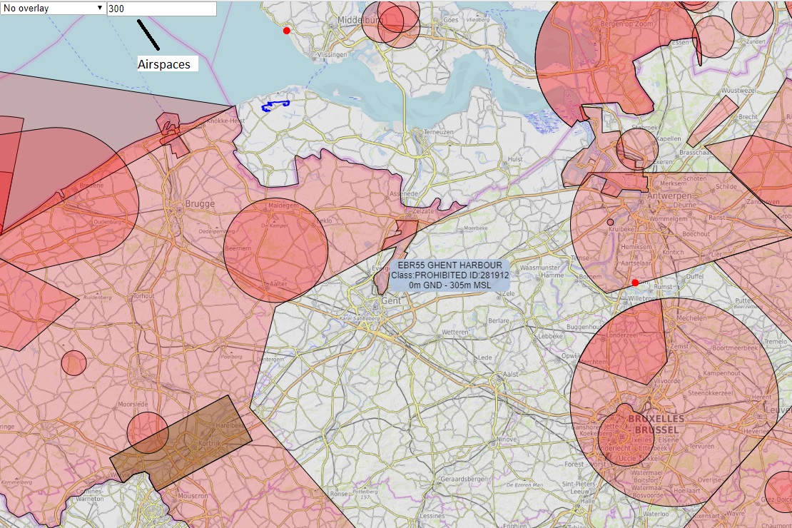
Class G airspace in green
Class E airspace in green
Height:
Temperature:
Precipitation:
Always safe Windspeed (ignore direction):
Windspeed warning (orange):
Windspeed Alarm (red):
Use icon-D2 model as groundwind.
(Datapoints are closer together, but is only available for parts of Europe.
Usefull in complex valley-systems (ex: The Alps)).
Class G airspace in green
Class E airspace in green